Built to Scale.
Designed to Secure.
Precision-engineered GIS cloud infrastructure for intelligence operations. From a lean single-machine deployment to a complex multi-server environment - or a fully air-gapped secure enclave - we design every layer before a single server is provisioned.
✽ CLOUD ARCHITECTURE
Architecture Is the Foundation Everything Else Depends On
A poorly designed cloud architecture costs you in three ways: performance bottlenecks you can't fix without rebuilding, security gaps discovered only after a breach, and an infrastructure that can't scale when your operational demands grow. We design that foundation before any server is touched.
Our architects don't work from generic templates. Every Black Thunder architecture is drawn from scratch around your specific GIS workloads, SAIMOS video analytics requirements, data volumes, user concurrency, and security obligations.
✽ DEPLOYMENT MODELS
Four Configurations.
One Right Answer for You.
We evaluate your environment, workloads, budget, and security requirements - then recommend the deployment model that fits. No upselling to complexity you don't need.
All Components, One Optimised Server
Your complete ArcGIS Enterprise environment — Server, Portal, Data Store, and Web Adaptor — deployed on a single cloud instance. Cost-efficient, straightforward to manage, and fast to stand up. The right choice for smaller operations, pilot programmes, or organisations beginning their cloud journey.
- ArcGIS Server, Portal, Data Store and Web Adaptor on one VM
- Right-sized instance selection for your workload profile
- Automated backups and snapshot management
- SSL-encrypted access from day one
- SAIMOS integration on the same host or a linked VM
- Straightforward upgrade path to multi-machine when needed
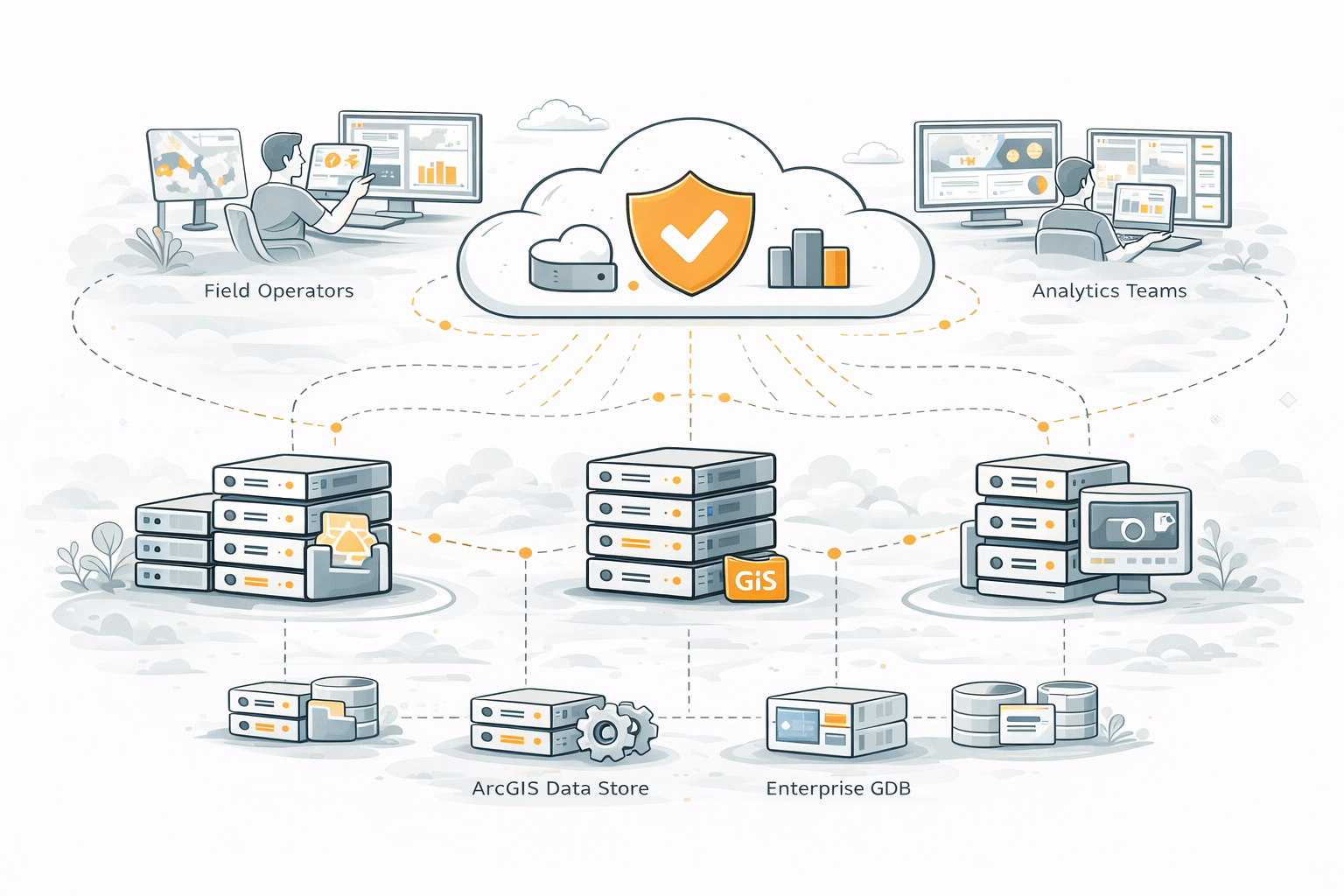
Independent Servers. Maximum Performance
Each ArcGIS Enterprise component runs on its own dedicated server, allowing each to be independently scaled, patched, and optimised. This is the production standard for organisations with significant concurrent users, large datasets, and high-availability requirements.
- Dedicated VM per component — Server, Portal, Data Store, Web Adaptor
- Independent horizontal scaling per service tier
- No single point of failure — component isolation prevents cascade failures
- Load balancer across multiple ArcGIS Server nodes
- SAIMOS on a dedicated AI compute instance
- Separate LiDAR processing node for heavy workloads
Architecture Designed Around Your Exact Requirements
When your GIS environment has unique workflows, complex integration points, specific data residency requirements, or needs that don't fit a standard pattern — we design from scratch. A custom configuration starts with your requirements, not a template.
- Architecture discovery workshop before any design begins
- Hybrid cloud and on-premises topology where required
- Custom network segmentation and security zones
- Bespoke integration of SAIMOS, LiDAR, and sensor feeds
- Multi-region or multi-zone redundancy if needed
- Full architecture documentation and decision rationale
Fully Isolated. Zero External Exposure.
For classified, defence-adjacent, or operationally critical environments where no external network connectivity is permissible. Our air-gapped architecture design places your entire GIS and intelligence stack inside a fully isolated network enclave — with no path to the public internet and strict physical and logical access controls throughout.
- Complete network isolation — no internet connectivity by design
- Private data centre or dedicated government cloud enclave
- All software updates delivered via secure offline media
- Hardware security modules (HSM) for key management
- Physical and biometric access controls documented
- Meets MilSpec, government, and national security requirements
Start with a 45-minute discovery call. We'll ask about your current environment, your team size, your workload profile, and any security or compliance requirements. From that conversation, we'll outline the most appropriate deployment model and the scope of the architecture engagement. No obligation, no sales pressure — just a technical conversation to establish whether we're the right fit. Call +971 2 236 7933 or contact us via the form below.
✽ FAQ
Frequently Asked Questions
Questions we hear most often from organisations planning a GIS cloud architecture engagement.
Let's Design Your Cloud Architecture
Start with a no-obligation discovery call. We'll assess your requirements and outline the right architecture for your organisation before any work begins.
Contact Us Today